The Colorado River Is No Longer Just a Water Story
The Colorado River is no longer just a water story. It is becoming a system-exposure issue linking reservoirs, hydropower, cities, agriculture, industry, and long-term planning across the American West.

The Colorado River Is No Longer Just a Water Story
Raven Intelligence Framework (RIF)
— A. Nickoll
Raven Intelligence
© 2026 Raven Intelligence — All Rights Reserved
The standard framing of the Colorado River crisis focuses on drought, reservoir levels, and agricultural water cuts. That framing is now structurally incomplete.
What is actually happening across the Basin is a bifurcation. Industrial and strategic users — semiconductor fabrication plants (fabs), artificial intelligence (AI) datacentres, and large-scale compute infrastructure — are not sitting in the same water queue as cities, farms, and households. They are entering the system through separate allocation pathways, purpose-built recycling infrastructure, and long-term utility agreements. They have their own lane.
The civilian population is not the primary user competing with industry. It is increasingly the residual user — absorbing whatever remains after strategic industrial loads are served.
That is the deeper story. Not collapse. Not drought panic. A governing system making structural choices about whose continuity gets protected first.
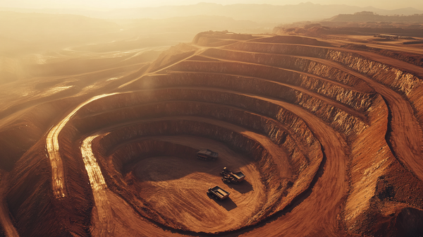
The Reservoir Situation — Current State
The Bureau of Reclamation's May 2026 24-Month Study is unambiguous. The April–July 2026 unregulated inflow forecast into Lake Powell is 0.800 million acre-feet (maf) — 13% of the 30-year average. The May 2026 monthly inflow forecast alone is 0.180 maf, or 9% of average. (Confirmed external — Bureau of Reclamation, May 2026)
In response, federal managers announced in April 2026 that they would reduce Lake Powell's annual release to Lake Mead from 7.48 maf to 6.0 maf — the lowest release volume in decades — while releasing 660,000 to 1 maf from Flaming Gorge Reservoir, on the Utah–Wyoming border, to help stabilise Lake Powell. The combined actions are expected to raise Lake Powell's elevation by approximately 54 feet to at least 3,500 feet by April 2027. (Confirmed external — Bureau of Reclamation, April 2026)
The trade-off is explicit. Reclamation's own announcement warned that reduced Powell releases could accelerate the downstream decline of Lake Mead, with the potential for up to an additional 40% reduction in Hoover Dam's hydropower generating capacity as early as autumn 2026. (Confirmed external — Bureau of Reclamation, April 2026)
Lake Mead's most probable elevation at end of 2026 is projected at 1,039.62 feet — approaching the 2022 record low of approximately 1,040 feet. In the worst-case scenario modelled by Reclamation, Lake Mead could reach 1,036 feet, a new record. (Confirmed external — Bureau of Reclamation May 2026 24-Month Study)
The system is not being fixed. It is being triaged. Pressure moved from Lake Powell to Lake Mead, and from Lake Mead to the downstream users who depend on it — the Central Arizona Project (CAP), Southern Nevada, and Lower Basin agriculture.
The seven Basin states have not reached consensus on a new operating framework. The existing agreements governing reservoir operations for 20 years expire in 2026. Without a new agreement, the Interior Department has indicated it will determine post-2026 operations unilaterally. (Confirmed external — Bureau of Reclamation, April 2026)
Who Actually Uses the Water
The dominant narrative positions semiconductor fabs and AI datacentres as the primary threat to Colorado River water availability. That framing is numerically wrong, and understanding why it is wrong matters more than the headline.
Agriculture accounts for approximately 75% of beneficial consumptive use across the Colorado River Basin. Irrigation for cattle-feed crops — alfalfa, hay, corn silage — alone accounts for an estimated 32% of the entire river's flow. All municipal, commercial, and industrial uses combined represent approximately 18% of consumptive use across the Basin for the 2000–2019 period. (Confirmed external — Richter et al., 2024, NASA Landsat-aided research)
In Arizona specifically, agriculture uses approximately 68% of total state water, municipalities approximately 25%, and industry approximately 7%. Arizona's nearly 200 datacentres and chip factories currently use less than 1% of the Phoenix area's total water supply. In Maricopa County in 2025, datacentres used 905 million gallons — compared to golf courses, which used 29 billion gallons. (Confirmed external — Arizona Capitol Times, April 2026; Grist, March 2026)
The TSMC (Taiwan Semiconductor Manufacturing Company) fab complex in north Phoenix, Arizona, when all planned fabs are operational, is projected to use up to 40,000 acre-feet per year — approximately 4% of the total water in the Central Arizona Project allocation. TSMC's first fab uses approximately 4.75 million gallons daily, of which 65% is internally recycled. TSMC broke ground in 2025 on a 15-acre industrial water reclamation plant expected to reach 85–90% recycling when operational in 2028. (Confirmed external — Axios, August 2025; CommonWealth Magazine, 2023)
Intel, operating at its Ocotillo campus in Chandler, Arizona, has partnered with the city on a reclaimed water facility to supplement its cooling-system supply, reducing dependence on municipal potable water. A single fab uses approximately 8 gallons of water per chip produced and approximately 8.9 million gallons per day at full operation — making fabs large users by local standards, but a fraction of the agricultural draw on the Basin as a whole. (Confirmed external — Area Development, November 2024; Phone Arena)
The Bifurcation — Two Different Water Systems
The key insight is not about volume. It is about access architecture.
Industrial strategic users — fabs, large datacentres, major tech campuses — are not relying on the same water delivery chain as households. They enter the system through Arizona's Assured Water Supply (AWS) programme, which requires demonstrated 100-year supply availability before construction can proceed. They negotiate dedicated allocations, often from the Central Arizona Project's municipal and industrial priority tiers. They build on-site recycling and reclamation infrastructure specifically designed to reduce municipal intake dependence. They have guaranteed supply agreements, water banking credits, and in some cases dedicated reclaimed-water pipelines that bypass the household municipal system entirely.
The Buckeye, Arizona datacentre complex — a $20 billion, 2,000-acre campus built by Tract — illustrates the architecture directly. Buckeye's mayor explicitly stated that water is "on them to bring" — meaning the industrial operator is responsible for securing its own water supply, not drawing from the municipal system. The real constraint, in that mayor's framing, is power, not water. (Confirmed external — Grist, March 2026)
Arizona's legislature, as of March 2025, had also moved to explicitly prohibit management plans from requiring industrial users to obtain assured water supply certificates or meet residential-equivalent replenishment obligations — further separating industrial water governance from municipal water governance. (Confirmed external — Arizona Department of Water Resources, March 2025 Legislative Update)
This is the structural reality: strategic industrial users have their own water lane, governed by separate allocation tiers, separate legal frameworks, and separate supply infrastructure.
When the Colorado River tightens, the first pressure falls on agriculture, then on lower-priority municipal users, then on residential growth. Strategic industrial loads — carrying economic and geopolitical priority — are last in the queue to be cut, and in many cases operate outside the municipal queue entirely.
The Power Constraint — The Real Industrial Chokepoint
The actual binding constraint for fabs and AI datacentres in the Basin is not water — it is power.
Phoenix datacentres currently draw 1.5 gigawatts (GW) of power. A former Arizona utility executive disclosed that the Salt River Project (SRP) — Phoenix's government-owned utility — had 42 datacentre projects on its books totalling more than 10,255 megawatts (MW). SRP would need to more than double its current generation resource mix to serve that load. (Confirmed external — Stanford/And the West, April 2025)
The Hoover Dam hydropower system — already facing a potential 40% capacity reduction from declining Lake Mead levels — feeds into the same regional grid that serves both residential users and large industrial loads. A sustained decline in Hoover Dam generation tightens the grid that industrial operators depend on, even where their water supply is separately secured.
This is where the civilian and industrial systems converge in a way that cannot be separated by allocation architecture: both depend on the same power grid, and that grid depends partly on the same reservoir system that is under triage.
The water bifurcation is real, but the power system is not bifurcated in the same way. Reservoir decline reaches strategic industrial users through grid stress, even when it cannot reach them through water allocation cuts.
The Civilian Residual — What This Means for Everyone Else
In the worst-case Central Arizona Project (CAP) shortage scenario, the federal Department of the Interior could cut almost all water deliveries through the CAP canal system serving central Arizona. That would eliminate supply equivalent to approximately a quarter of the Phoenix and Tucson regions' total water usage, forcing contraction across homes, businesses, farms — and, at scale, datacentres that do draw any municipal supply. (Confirmed external — Grist, March 2026)
Arizona has stored nearly 3 trillion gallons of water in underground aquifers — enough to supply Phoenix for approximately 30 years — as a strategic buffer. But the Phoenix Active Management Area groundwater model, as of 2023, showed that all physically available groundwater is already fully allocated. New residential development outside existing designated water provider service areas cannot obtain a 100-year water supply certificate based on local groundwater alone. (Confirmed external — Arizona Department of Water Resources; Morrison Institute Kyl Center, June 2023)
The civilian population — residents, small businesses, lower-priority agricultural users — is exposed to Colorado River shortage in a way that large industrial operators are structurally buffered against, at least in the near term. Strategic industrial users have longer runway. The civilian residual absorbs first.
The Raven Read
The Colorado River Basin is a live demonstration of a pattern Raven tracks across every major infrastructure system: the shift from open neutral access toward governed, tiered, and prioritised access.
Water is not running out uniformly. It is being allocated into tiers. Strategic industrial users — fabs, AI datacentres, compute infrastructure — have secured positions in the higher-priority tiers through capital investment, political alignment, dedicated infrastructure, and separate legal frameworks. Residential and lower-priority agricultural users sit in lower tiers. When the system tightens, the lower tiers compress first.
Power is the shared dependency that crosses all tiers. Reservoir decline reaching Hoover Dam's generation capacity is the vector through which Basin stress reaches strategic industrial infrastructure even where water allocation provides insulation.
The 2026 Compact renegotiation — the most consequential Colorado River governance event in decades — is proceeding without a Basin-state consensus. The Interior Department has indicated it will act unilaterally if needed. Whatever framework emerges will embed the tier structure for the next generation of water governance across the American West.
The Colorado River is not drying. It is being reprioritised.
The question for operators is not whether the Basin survives. It is whose continuity gets protected inside the new tier structure — and whether the power grid dependency provides the one channel through which that protection can still fail.
Signature
— A. Nickoll
Raven Intelligence
Informational intelligence only — not financial, investment, legal guidance, or political prediction. © 2026 Raven Intelligence — All Rights Reserved.
If this raised questions you haven't seen answered anywhere else — that's the point.
The Colorado River Basin is a live demonstration of a pattern Raven tracks across every major infrastructure system — the shift from open neutral access toward governed, tiered, and prioritised access. Raven tracks where thresholds are being crossed and what they mean for operators who depend on the systems behind them.
Entry, Core, and Elite tiers. Start with Entry and go as deep as your work requires.